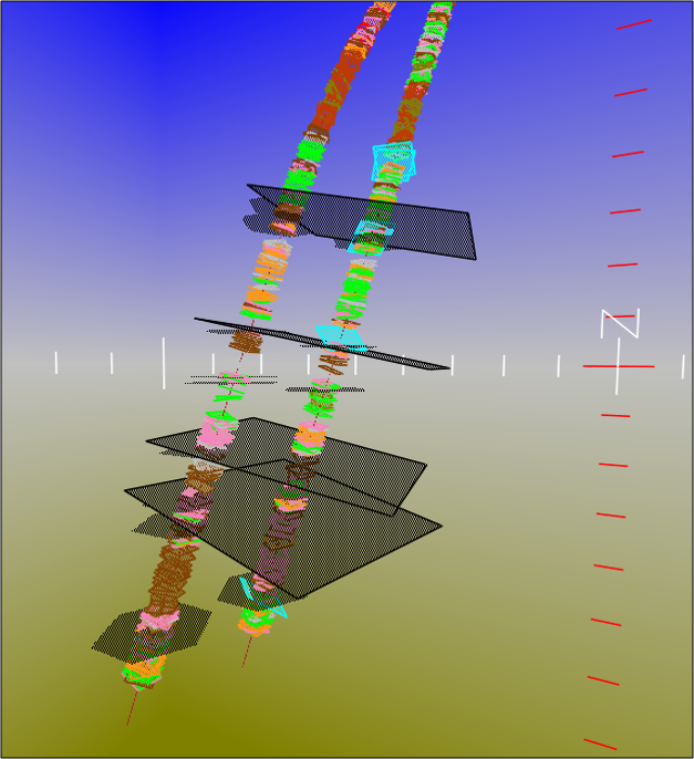
 Coded specifically for Task Fronterra Geoscience through Task Fronterra Geomodelling the Attitude Viewer software application provides 2D and 3D visualisation of the borehole image data to our clients.
This project-specific CD-ROM application contains all the borehole image-derived data from the Task Fronterra Geoscience interpretation. The software handles multiple wells with ease, allowing all data from a field or prospect to be accessed through a single, user-friendly interface.
- 2D cross-sections and plan views and 3D environments are provided as standard.
- Apparent dips are calculated on the fly for the cross-section as the line of section is adjusted.
- Filter data displayed by well and data types.

- Plot-specific positional manipulation.
- Overlay stratigraphical and other interval information.
- Previously interpreted well data can be loaded to existing or new projects.